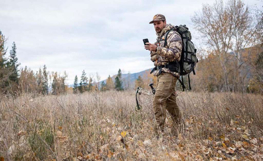
Imagine it is October 10. You have one week of vacation time left to schedule off at work. You are sitting at your job site trying to debate when to take the time off. Then you remember that your buddy told you about the MoonGuide app. You download it, unsure of what to expect. As you dive into the app, you notice that the last week of October is shown in red, unlike the rest. You figure out these are the red moon days. These are supposed to be the best days to hunt in October. On top of that, you’ll be heading right into the rut then. So, you call your boss and schedule your vacation.
In a world where everyone is connected to the internet, and it is rare to not have a smartphone, why not get the most out of connectivity? There are several different apps available geared toward us outdoor people. Some of them are for mapping, stand placement, and scouting. Some of them are more for wildlife movement prediction. Let’s take a dive into some of the top apps out there and see what they have to offer. This should better help you decide what ones are best suited for your needs.
Mapping Apps
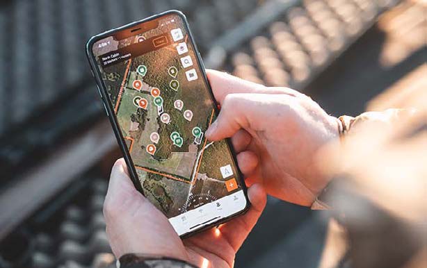
Let’s start with the mapping-based apps. These all share a lot of the same features, but each has its own unique characteristics. They all allow you to view some sort of aerial view of your hunting property. They all allow you to use some sort of markers. They all allow you to view the wind direction and weather. Those are about the only things that are the same on the apps onX, BaseMap, and HuntStand. Other apps like HuntWise and MoonGuide also offer these features, but those two also offer a lot more features.
Let’s Start with OnX
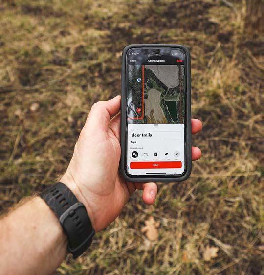
This is a very popular app with two different purchase plans and a free plan. You can either purchase it with one state, and get information only for that state, or you can purchase the elite package for all 50 states and Canada. The onX app has many great features and layers. Some of my go-to favorites are the property line and owner information feature, the state land feature, and the crop rotation layer. (Several other layers are offered, but that’s a whole article in itself.)
Some of the other key things that set onX apart from the rest is that it lets me set preferred winds for each of my hunting spots. I can then open the map and see the wind in real time, color-coded to show which of them is my best stand to hunt on that wind. This app also has several different pin icons to choose from. Some of the main ones I use are stand locations, rubs, scrapes and trail cam locations. I can even send my hunting partner a pin to open up in his own app. Having the trail cam locations is a big feature, especially in the summer. I can open my app and go straight to the camera. OnX can also perform things like measuring distances, tracking your location and adding pictures to your points. The app even has a wind calendar.
HuntStand
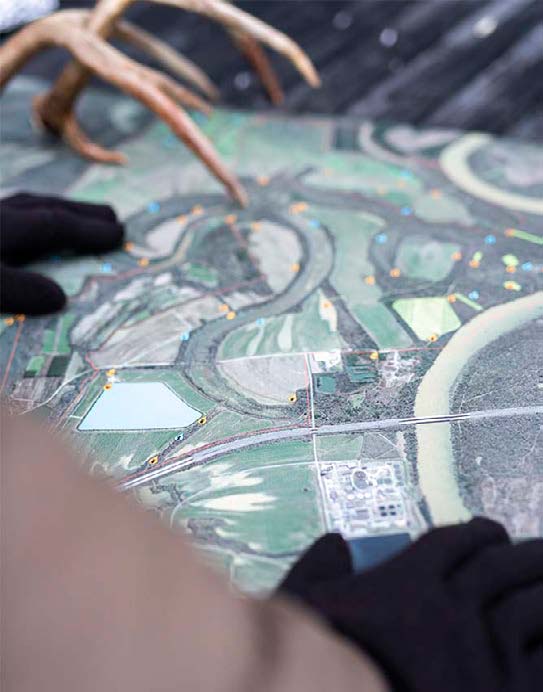
Next up, we will cover HuntStand, which is another very popular app. This app also has several different map layers, just as onX does. It offers a look at property lines and owner information. It has several different pins that you can use to mark objects such as trail cameras, stands and food plots. The app even has separate tabs built in for just looking at trail cameras, stands, animal sightings and even places of animal harvest. This is a great feature because with the tabs, your main map area isn’t cluttered with these icons. When I run trail cameras, I like being able to just see the trail camera locations. The HuntStand app also offers several pin icons, such as traps, stands, feeders and other pins. The wind map is broken down in 12-hour increments that go out for 72 hours. It shows wind direction and speed, and also shows waterfowl wind direction. There are several other map layers such as tree cover, topography, and even 3-D. One of my favorite features with HuntStand is a high-definition printable map option so you can print out your hunting area. This is perfect for the hunting cabin. Like most of these apps, a few different pay options are offered along with a free version.
BaseMap
The last one I want to cover on the mapping side is BaseMap. This app offers a pro subscription and a free subscription. There are a lot of basic mapping layers and topo maps in this app. I found it is not as accurate in pinpointing your location as the other two apps mentioned. BaseMap offers pins to mark locations but doesn’t offer as many as those with color options or specific pins. I do like the fact that you can check wind in a 24-hour period with this app. It shows up looking like smoke blowing on the map. It’s a great feature since it allows you to see how your scent will travel over your hunting area. The app does allow you to set wind on each stand, but it’s not as user-friendly as onX in this regard. The app also allows you to track, add photos and measure distances. It has a built-in harvest log, which is another great addition. It allows you to record animal harvests with pictures, and it stores the weather data from that day.
Trophy Scan
For those hunters who want more than just mapping and scouting tools, Trophy Scan stands out by offering a modern, tech-forward way to measure, preserve, and celebrate your harvest. With Trophy Scan Mobile, what once required tape-measures, score-sheets, and careful bookkeeping can now be done in minutes using just your iPhone — no more guesswork, no more manual calcs.
Trophy Scan uses advanced 3D scanning technology powered by LiDAR-equipped iPhones (iPhone 12 Pro and newer, Pro or Pro Max), enabling the creation of detailed, lifelike models of antlers — whether whitetail, mule deer, or elk. Once the scan is captured, the app applies proprietary “Volumetrics” algorithms and scoring software to instantly generate an accurate field score, comparable to traditional manual measurements — but far faster and often more consistently.
Beyond accuracy and convenience, one of Trophy Scan’s greatest strengths is its ability to store and preserve every trophy digitally. Hunters can archive unlimited 3D scans in the cloud, ensuring that even if a physical mount is lost or damaged, the memory (and the data) remains intact. This “digital trophy room” also allows for sharing: completed scans can be turned into shareable GIFs or uploaded to the app’s public feed, letting you show off your harvest, compare antler metrics with friends, or simply build a personal archive of every buck or bull taken over the years.
For hunters, outfitters, or taxidermists wanting an “official” score — whether for record-keeping, trophy management, or bragging rights — Trophy Scan offers certified scoring as a paid add-on. This blends the convenience of digital scoring with the credibility of traditional scoring methods, giving users flexibility depending on their needs.
In short, Trophy Scan doesn’t just digitize antler scoring — it transforms it. It makes scoring fast, repeatable, portable, and sharable. Instead of fumbling with measuring tapes in the field, you simply open the app, scan, and get a reliable score. Instead of physical scrapbooks or loose photos, you get organized, permanent digital records of every trophy — accessible from anywhere. For hunters who value precision, legacy, and ease, Trophy Scan brings trophy-scoring into the modern age without sacrificing tradition an is our favorite deer scoring app.
Any of the Above
I don’t think you can go wrong with any of the three apps mentioned above for mapping. They all offer a lot of the same basic features, but once you work with them a little, you’ll find the differences. I have purchased and used all three of them in the past and couldn’t tell you a favorite. I will say that when you test them out before purchase, bring the app up on a computer. It is a lot easier to use and it is a great way to scout digitally for any upcoming hunting trips. I personally love to do this before traveling to any state land. This allows me to get the lay of the land, along with parking and camping information, and to check on anything else I need to know.
Three More for Deer
Next up are features specific to deer hunting-related apps. The three I am going to cover are Adam Hays’ MoonGuide, the Drury’s DeerCast and Jeff Sturgis’ HuntWise. I will start by saying that I subscribe to all three. They are all different with the content they provide, and all three provide quality content. I have found that having two little kids means I must hunt on the days that give me the best chance to tag a mature buck. These three apps do just this.
MoonGuide
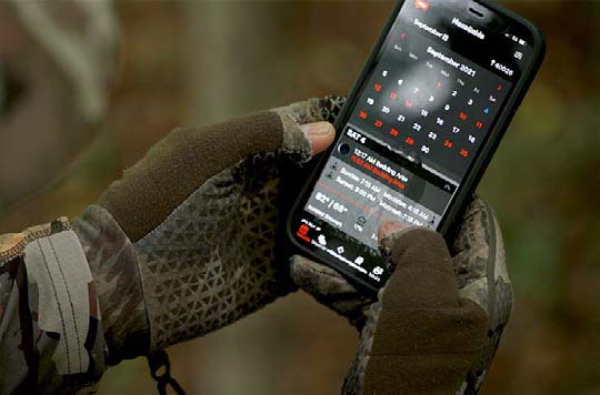
Let’s start with Adam Hays’ MoonGuide. (If you aren’t familiar with Adam, look him up. He’s a big buck killer having four bucks measuring over 200 inches on his wall.) Adam has developed an app to track the red moon days. These are the days that the moon has the most influence on a deer’s natural movement. When you look at the MoonGuide you see the red days. Once you click on a red moon day, it gives you information on the best place to hunt, such as field edge or bedding area; the key time to be in the stand; the weather; and sunrise and sunset.
That’s not all the app has to offer, either. It has an easy-to-use journal that allows you to track deer movement and include pictures. It has basic mapping that is not as advanced as other apps, but the mapping isn’t bad. My favorite feature besides the red moon report is the predictions section of the app. This is where Adam breaks down his recommendations for hunting each month. There is a lot of great advice contained here that will be beneficial in helping you schedule your time off. And who better to get advice from than a guy who constantly kills big deer?
DeerCast
Next up let’s talk about DeerCast. This is the creation of Mark and Terry Drury of Drury Outdoors.
This is another great app. It offers both a free and paid version. The app uses an algorithm the Drurys developed to help predict the best days to hunt. It uses different variables, such as weather, barometric pressure, time of season and historical information. These two guys have a record that speaks for itself, and this is how they predict what days they want to hunt. They break down each day by morning and evening. You can even look at the day hourly. They have videos on each day that explain the phase of deer season and key things to look for.
The app also offers basic mapping. It is completely customizable (such as if they have an okay prediction and you think the reality is better for your area, you can adjust that). This app also allows you to view the Drurys’ entire hunting library. But my favorite feature of this app is the DeerCast track. This allows you to look at a Whitetail and click on the body to where your arrow hit the deer. It will then let you look at a skeletal view to see vitals. As if that’s not enough, it will bring up several videos of deer being shot in that spot and how they reacted. It then gives you estimated times to start tracking and tips so as not to lose the deer. This is a great feature, and I will sometimes click spots to see how the deer reacts to help better prepare for the upcoming season.
HuntWise
The last of the apps I want to discuss is Jeff Sturgis’ HuntWise. This is another must-have app. (If you’re not familiar with Jeff, Google “Whitetail habitat solutions;” you can thank me later.)
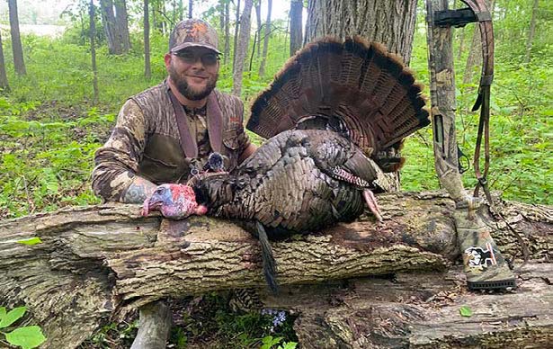
I wrote a whole article about this app and can confirm that it’s not like any of the rest. It allows you to set target species from Whitetail to turkey, elk to waterfowl, and even small game. It then predicts movement for these animals. I strongly believe this works. For example, this year on the best day of the week to hunt turkey, my buddy and fellow Whitetail junky Dusty Kroft shot his biggest bird to date. This happened within minutes of the peak movement time predicted. The app also offers several other applications, including mapping like the three apps mentioned above, along with tips for scouting and rut predations. This information comes from the Whitetail 365 strategy. It even allows you to set up alerts for peak hunting times in different areas. This is one app that I will always have on my phone.
In closing, in this day and age, everyone has a smartphone, so if it is with you anyway, why not use it to make hunting a little easier? There are also apps for most cell cameras and even states that have hunting license and regulations on these. I don’t think you can go wrong with any of these apps, but I do advise trying the free versions first to see which of them best suits your needs.
Per our affiliate disclosure, we may earn revenue from the products available on this page. To learn more about how we test gear, click here.


